When a farmer cuts down a tree in the Democratic Republic of Congo, there’s often a reason for it. She’s most likely clearing the land to plant crops — the…
It’s become a trend for big corporations to pledge that their products won’t cause any more deforestation. And while many experts believe in the potential of these “zero-deforestation” commitments to…
Imagine you needed to map the spread of an invasive plant species in a tropical forest. Hyperspectral imaging and LiDAR are great at identifying vegetation, but have their limitations and…
The Brazilian Amazon lost 184 km2 of forest in December 2017, according to the country’s Institute of Man and the Environment of the Amazon (Imazon). The data, obtained exclusively by…
Experts say 2017 Brazilian wildfires were caused not principally by drought, but mostly set by people, and worsened by human-caused forest degradation. Agency budget cuts worsened the crisis.
Pres. Trump’s 2018 budget would kill new satellites vital to climate research and weather forecasting, hobbling international science. A congressional budget vote may come next week.
Technology above the clouds is helping scientists study sharks beneath the waves. A new initiative combines shark movement data with publicly available vessel identification data—both transmitted to researchers via satellite—to…
A satellite-based alert system can now detect fine-scale deforestation in near-real time, enabling managers or rangers in tropical forests to respond to early stages of deforestation. Anyone can now register…
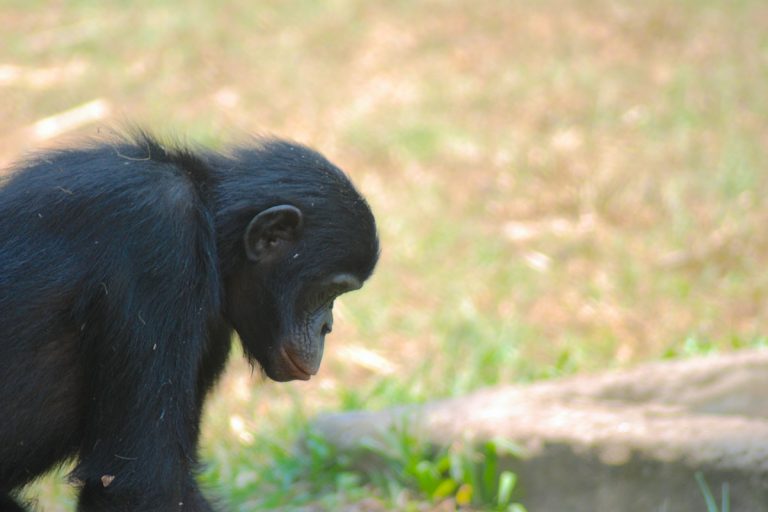
Carbon-rich tropical forests, which are often among the least-disturbed habitats, seem to be ideal bastions for sensitive and threatened animals, particularly compared to lower-carbon areas like timber and oil palm…
A new study found that mining caused nearly 10 percent of deforestation in the Brazilian Amazon between 2005 and 2015, not the 1-2 percent assumed by past assessments.
A recent study mapped the world’s dry forests using a relatively new tool that combines creative satellite image analysis with local- and national-scale knowledge. Natural resource agencies worldwide inventory their…
During the wet season, manatees swim Amazon basin floodplains; in dry times they migrate to lakes. Hundreds of planned dams could disrupt that cycle.
Summer sea ice didn’t reach its lowest extent on record in 2017, but that’s not the only measurement that matters, experts warn.
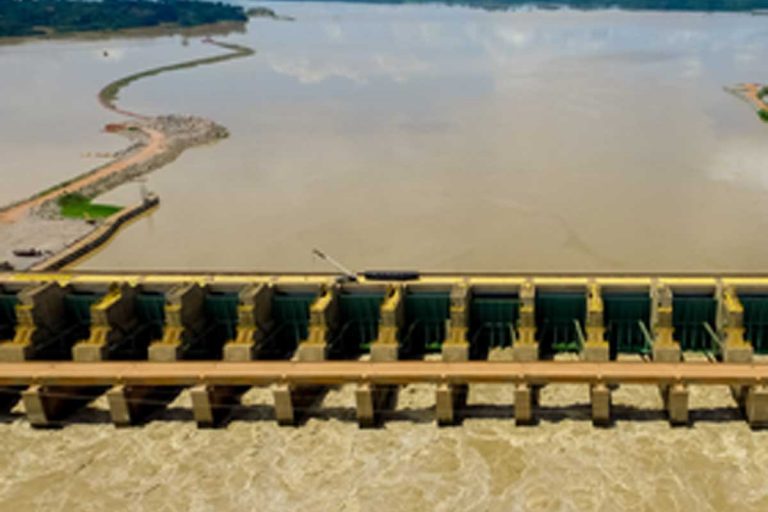
Study warns that six hydroelectric mega-dams proposed for Andean highlands would put environment and food security at risk in Amazon basin.
Tool helps communities, researchers, policymakers, activists assess a proposed dam’s economic viability, greenhouse gas emissions and more.
Brazil’s president approves new criteria for indigenous land demarcation to deny Indians their traditional lands; opens door to elite land thieves, agribusiness, opponents say.
Satellites are mechanical reporters of the Amazon deforestation process. By documenting the degradation and gaps created by the clear-cutting process over the years, they deliver the verdict: two-thirds of the…
Many dozens of major infrastructure projects — including highways, dams and mines — have been given the green light in the Brazilian Amazon in recent years, and hundreds more are…
The Madeira River, one of the Amazon’s major tributaries, is the focus of intense hydroelectric dam development, part of a massive wave of infrastructure construction occurring across the Amazon basin.…
To some, watching sea ice melt — each floe dissolving slowly away into the Arctic Ocean — might seem the cold-weather equivalent of watching paint dry. But for the roughly…
In March 2017, when Arctic sea ice is typically at its maximum winter extent, circling U.S. satellites recorded an extent of just 5.57 million square miles — the lowest maximum…
To understand the resource needs of a species, you need to know where individual animals go and what they do there. You can follow some animals around on foot or…
Map for Environment is a free online open-source mapping platform that offers spatial data, tools, and hosting to encourage a wider environmental community to produce maps and increase transparency in decision-making.
Few places on Earth escape the reach of humankind, and those areas are dwindling, according to a new study. Between 2000 and 2013, the world lost a Venezuela-sized expanse of…
The grayish-white form of the ghost of the mountain slinks through the snowcapped slopes of Central Asia. Its remote, harsh habitat, cryptic coat and elusive nature have impeded investigation and…
The United Nations/Kenya Conference on Space Technology and Applications for Wildlife Management and Protecting Biodiversity aims to expand the use of space technology in conservation.
overnments have been establishing enormous marine protected areas (MPAs) spanning hundreds of thousands of square kilometers where fishing is restricted. And the United Nations last June began work developing an…
Deforestation jumped 16 percent in the Brazilian Amazon to 5,831 square kilometers for the year ended July 31, 2015, but still remained well below historical levels, according to data released…
When a buildup of hot gases and magma burst through the rock and ice covering Mount St. Helens in 1980, the ensuing eruption leveled huge swaths of the surrounding pristine…
With political pressure mounting on plantation companies, including threats of fines and legal action by the Indonesian and Singaporean governments and boycotts in consumer countries, palm oil and timber giants…
Activists have documented a palm oil company destroying lowland rainforest in Sumatra's endangered Leuser Ecosystem. Last month, Rainforest Action Network (RAN) reported that PT. Tualang Raya was clearing rainforest in…
While fires in Borneo and Sumatra are garnering most of the headlines for the choking air pollution they are causing across Southeast Asia, New Guinea is also experiencing widespread fire…