• English
  • 中文 (Chinese)
  • Deutsch (German)
  • Español (Spanish)
  • Français (French)
  • Bahasa Indonesia (Indonesian)
  • Italiano (Italian)
  • 日本語 (Japanese)
  • Brasil (Portuguese)
  • India
  • Philippines
  • हिंदी (Hindi)
  • Mobile
  • Conservation Drones
  • Monitoring
  • Satellite imagery
  • Tracking
  • Human-wildlife Conflict
  • More

Pennsylvania News

In Pennsylvania, agroforestry holds a key to cleaning up waterways and Chesapeake Bay

by Sarah Derouin 27 May 2021
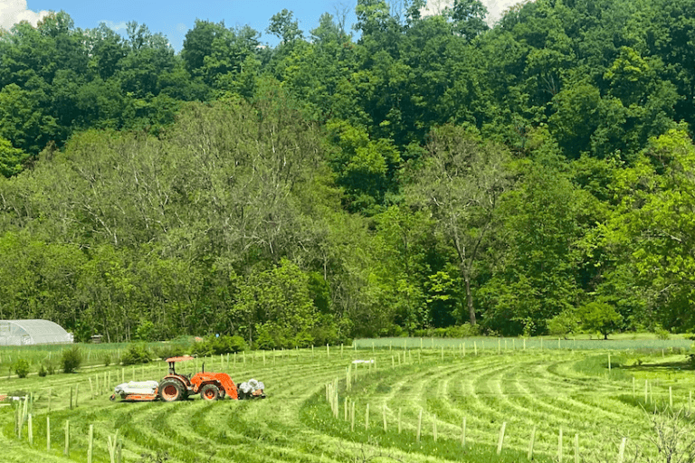
From her porch on Village Acres Farm in Mifflintown, Pennsylvania, Angela Brubaker can see the curved rows of trees in the new riparian buffer along Lost Creek. The tree tubes…

Geospatial data for the people, by the people

by Suzanne Palminteri 6 February 2016
SkyTruth’s FrackFinder project combines remote sensing, cloud computing, and an engaged public to map drilling and hydraulic fracturing using crowd-sourced image analysis of satellite and aerial imagery.

Popular Topics

AcousticAlertAnalysisBatteriesCamerasCitizen ScienceCommunicationConservationCrimeCryptic / hiddenDataDNADrones /UAVsEarly warningEducationForestsGPSHandheldHuman-wildlife conflictImagesLaw enforcementLow-techMappingMeasureMobileMonitoringOceans / marineOpen sourcePoachingPortablePowerProtectionReal-timeRemote sensingResearchSatellite imagerySensorsSoftwareSurveillanceSurveysTaggingTrackingTradeVideoWildlife

Recent Posts

  • Experts hack away at portable DNA barcode scanner to fight timber and wildlife trafficking
  • Hot stuff: improving chili fence effectiveness (in protecting crops from elephants)
  • Solving Global Grand Challenges, One MOOC at a Time
  • Understanding the ghost of the mountain
  • An oil-palm plantation with a few remaining rainforest trees in Sarawak, Malaysia. Photo by Rhett A. Butler.
    How to use the Bloomberg Terminal for advocacy work: advanced tools

© 2023 Copyright Wildtech