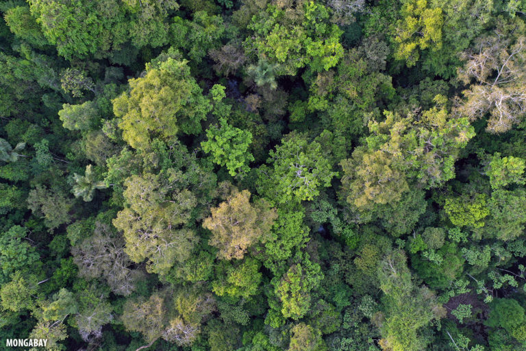
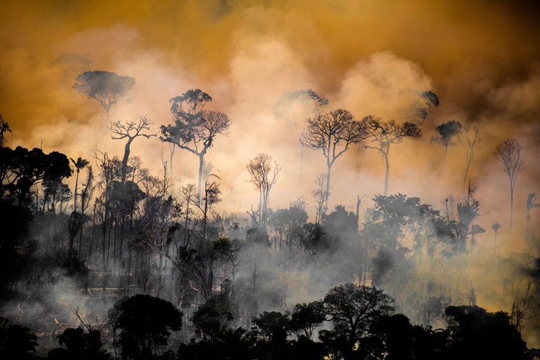
Rainforest destruction in the Brazilian Amazon exploded in August with deforestation reaching 1,661 square kilometers (641 square miles) — an area more than 28 times the size of Manhattan —…
Deforestation is on track to register a near-15-year-high in the Brazilian Amazon according to data published earlier this month by Imazon, an organization that independently monitors forest loss in Earth's…
Deforestation in Earth's largest rainforest is on track to rival last year's 15-year-high according to data released today by the Brazilian government. INPE, Brazil's national space research institute, today published…
Deforestation in the Brazilian Amazon is off to the fastest start for the first half of any year since 2008 according to government data published today. Deforestation alert data from…
PEKANBARU, Indonesia — Reportedly home to 3% of the planet's mammal species and one of the highest levels of lowland plant diversity known to science, Indonesia’s Tesso Nilo National Park…
Google and the World Resources Institute (WRI) this week announced the launch of a new mapping tool touted as providing an unprecedented level of detail about how land is being…
Deforestation in the Brazilian Amazon exceeded 1,000 square kilometers in April, the highest total since 2008 and roughly twice the level of April 2021, according to data released today by…
How do you keep an eye on the expansive ocean? You could hop on a boat and get really close to the water. You could do it from tens of…
Established in 1936 and situated just 200 kilometers (125 miles) from the sprawling megacity of Lagos, Akure-Ofosu Forest Reserve has long been a sanctuary for Nigeria’s diverse and dwindling wildlife.…
The rate at which carbon escaped from the deforestation of tropical forests more than doubled in the first two decades of the 21st century, according to new research. Earlier assessments…
Deforestation in the Brazilian Amazon is off to its fastest pace to start a year since at least 2008 reveals data published on Friday by Brazil's national space research institute,…
The fire season in Chiang Rai, Thailand’s northernmost province, lasts from February to April every year. During these months, dry weather causes ordinarily green vegetation to turn dry and flammable.…
Deforestation in the Brazilian Amazon last month was the highest of any January dating back to 2008, reports Brazil's national space research agency INPE. According to data released today, 430…
In November 2020, Peruvian cacao company Tamshi filed a lawsuit against Mongabay Latam staff reporter Yvette Sierra Praeli for “aggravated defamation” over her reporting of a government investigation into the…
Deforestation in Earth's largest rainforest surged 22% to the highest level since 2006, according to official data released today by the Brazilian government. Preliminary analysis of satellite data by Brazil's…
On Tuesday, November 2, 2021, 127 countries signed the Glasgow Leaders’ Declaration on Forests and Land Use, pledging to “halt and reverse forest loss and land degradation” by 2030. The…
A new study has found that China’s coastal wetlands have undergone significant recovery within the last 10 years after several decades of loss and destruction. An international team of researchers…
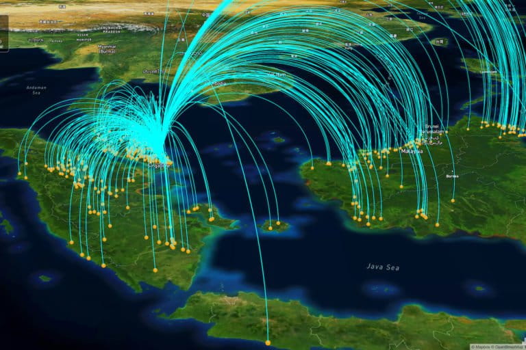
JAKARTA — A new web monitoring platform aims to achieve full traceability in palm oil supply chains and help companies to meet their zero-deforestation commitments — a goal that continues…
When the threats of potential mining activity arrived in the Bolivian community of Las Mangas, in the Indigenous Lomerío territory, the community held a meeting where they decided to put…
The loss of forest in an island province in Papua New Guinea (PNG) surged in August, according to satellite data. The target of these forays is likely timber, at least…
Before the clearing and excavators and bulldozers, before plans to build a gold mine and oil palm plantations, the Jemaluang and Tenggaroh forest reserves in Johor, Malaysia, were wildlife-rich jungles…
Protected forests, such as those in national parks, are unlikely to be cut down when surrounded by intact forests. Conversely, when a protected forest’s neighboring lands are degraded, it’s likely…
Selective forest cutting in the Amazon is on the rise, according to data released on Friday by the Brazilian government. Monthly deforestation alert data published by Brazil's national space research…
One of the main fears about the Brazilian Amazon is beginning to materialize: logging is starting to move from the periphery of the rainforest toward the core of the biome,…
Deforestation in the Brazilian Amazon declined for the second straight month according to data released today by the Brazilian government. Brazil's national space research institute INPE detected 918 square kilometers…
Scientists have completed the first-ever global, high-resolution map of the world’s shallow tropical coral reefs. The map is part of the Allen Coral Atlas, an open-access, user-friendly coral reef monitoring…
Carved out of the narrow isthmus that connects the Malay Peninsula to the rest of mainland Southeast Asia, Myanmar’s southern Tanintharyi region rises from the Andaman Sea in the west…
The Brazilian Cerrado savanna, a global biodiversity hotspot that has already lost half of its area to crops and cattle, is at risk of no longer being monitored for deforestation…
Every evening, along the banks of the Rembau River in Malaysia, fireflies put on a spectacular display. Against the dark silhouette of the berembang mangroves (Sonneratia caseolaris) they dance, synchronizing…
Deforestation in the Brazilian Amazon declined slightly over the past 12 months but still reached the second highest level since 2008, reports the country's national space research institute, INPE. According…