Visual technology is a key tool for wildlife research and conservation at various spatial scales, as shown by the development of camera traps, live video feeds, high-speed videography and satellite…
Satellites are mechanical reporters of the Amazon deforestation process. By documenting the degradation and gaps created by the clear-cutting process over the years, they deliver the verdict: two-thirds of the…
A pair of NGOs teamed up with rangers in four parks in Uganda to assess the potential for cutting-edge forest monitoring technology to support protected area management through early detection…
Researchers have developed a new acoustic monitoring method to measure bees’ productivity to facilitate management and response to population decline.
Many dozens of major infrastructure projects — including highways, dams and mines — have been given the green light in the Brazilian Amazon in recent years, and hundreds more are…
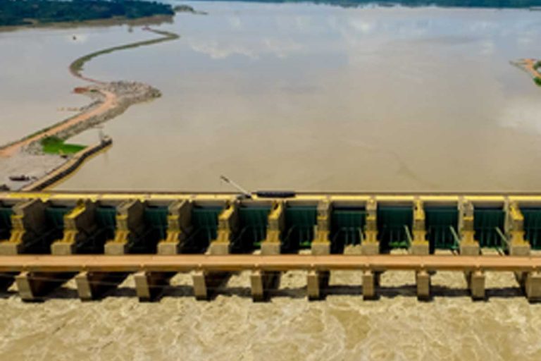
The Madeira River, one of the Amazon’s major tributaries, is the focus of intense hydroelectric dam development, part of a massive wave of infrastructure construction occurring across the Amazon basin.…
Researchers are branching out from an established monitoring technology to better study elusive canopy species.
To some, watching sea ice melt — each floe dissolving slowly away into the Arctic Ocean — might seem the cold-weather equivalent of watching paint dry. But for the roughly…
Researchers compared historical elephant movement corridors to current corridors from GPS data to determine the impact of human encroachment on elephants’ movement patterns in northern Tanzania.
In March 2017, when Arctic sea ice is typically at its maximum winter extent, circling U.S. satellites recorded an extent of just 5.57 million square miles — the lowest maximum…
Why track wild animals? How do wildlife biologists know where animals go and the resources they use? They watch them over sometimes extended periods. For millennia, people have watched animals…
It is regarded as the deadliest Ebola outbreak in human history: the 2014-2016 epidemic in West Africa claimed the lives of 11,325 people and resulted in 28,652 suspected, probable, and…
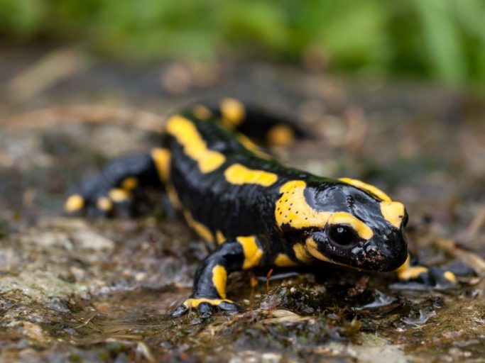
Undulating at the surface, the Salamandra robotica cruises through the water until it reaches the shore, then ambles forward through the sand with a lumbering gait on its four paddle-like,…
The Census of Marine Life (CoML), a 10-year international effort to determine the diversity of life found in Earth’s oceans, described over 1 million species, ranging from single-celled microbes to…
An innovative monitoring system analyzes satellite imagery to pinpoint illegal logging in the habitat of the Amur tiger and leopard.
Wildtech interviews Jennifer Gabrys, author of the book Program Earth, which discusses emerging sensor technologies and the cultural implications of an ever more “wired up” planet.
Automated acoustic monitoring of animal sounds can help assess faunal communities and detect endangered species.
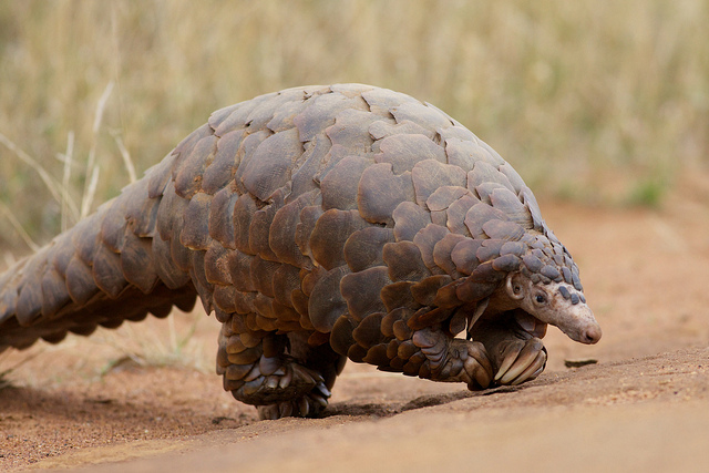
Remember that endangered anteater-esque ball of scales from Favreau’s recent film, The Jungle Book? That’s the pangolin, the world’s most trafficked mammal. Over one million pangolins have likely been poached…
What has a body like a shark’s, a saw protruding from its head and critically endangered status according to the IUCN? The largetooth sawfish is a species of ray that…
A short biodiversity monitoring manual is now freely available online
After Sri Lanka's 25-year civil war, researchers use camera traps to establish a baseline for the country’s leopard population.
Staying up to date with rapid advances in remote sensing technology to help conserve the Amazon rainforest
The grayish-white form of the ghost of the mountain slinks through the snowcapped slopes of Central Asia. Its remote, harsh habitat, cryptic coat and elusive nature have impeded investigation and…
The MAAP project integrates a range of satellite imagery and analysis tools to detect and disclose deforestation across the Peruvian Amazon.
Preliminary data suggests deforestation in the Brazilian Amazon may be on the rise after years of remaining at historic lows. According to data released last week by Imazon, a group…
What do lipstick, detergent and instant noodles have in common? They all contain palm oil. Half of every packaged product stocking supermarket shelves can be traced back to a ruthless…
Since its founding, the Jane Goodall Institute (JGI) has been on the forefront of conservation science, and in recent years the group has been applying remote sensing, mobile phone technologies,…
Global Forest Watch enables you to monitor tree cover and forest change for your region of interest in a free online platform.
The iSpot web application helps further biodiversity knowledge by connecting users interested in identifying the species they capture in photos.
Results of an assessment of the technology needs of front-line conservationists and researchers that informs wildtech.mongabay.com